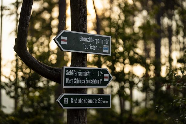
© Kenny Scholz

Well prepared for your hiking holidays

Nature experience is at home in Saxon Switzerland. Before starting a hiking tour it should be well planned. Here you find a lot of helpful information to perfectly prepare your hiking adventure. For some, the sign marked with “Ghs” might be the most important detail of the whole hiking. But what does it mean? Or what is a “Stiege”? Can I bring my dog for a hiking tour here and what actually means National Park?
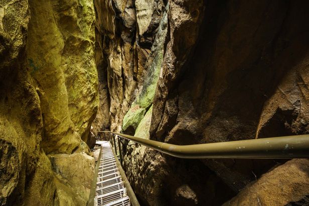
 

Be prepared for steep sections

Stiege in der Wolfsschlucht Hohnstein© Philipp Zieger

Almost everybody can go in for hiking. It is considered to be healthy and to make you happy, no matter if you are an experienced hiker or venture as a beginner on your first tour.

The Elbe Sandstone Mountains are different from other low mountain ranges in Germany and from the Alps. The great variety of natural forms in a very small area means hikers need to prepare for significant altitude differences on short distances. Hiking paths run over stairs and ridge trails. For narrow sections and plunging cliffs, a light daypack rucksack is recommendable. Surefootedness and a head for heights are also essential for a safe arrival at your destination.

But also less adept walkers find comfortable hiking trails in Saxon Switzerland. Get advice about them from one of the many local tourist information points.

A little lesson in signpost reading

Winterwandern im Schmilkaer Kessel© Sebastian Thiel

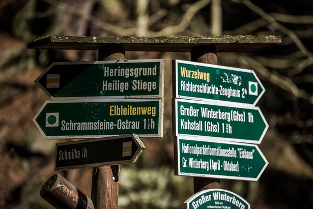
Signposts sometimes reveal more than expected, if you know how to interpret them.

  • “AP” means Aussichtspunkt (viewing point)
  • “Ghs” stands for Gasthaus (inn, eatery), and
  • “E3” is the sign for the European long-distance trail leading from the Atlantic coast via Saxon Switzerland to the Black Sea.

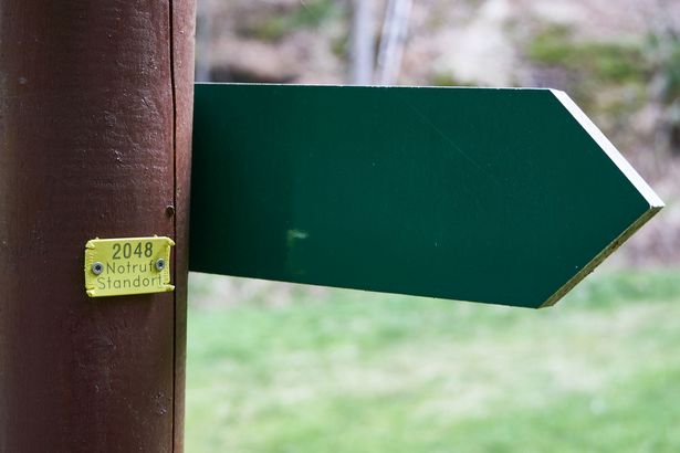
Small yellow plaques indicate the “Standortnummer” (local position number) which is important for the Mountain Rescue Service to quickly find the right place in case of an emergency.

Hiking trails are marked with a bar, slash or dot in different colours.  A special sign with a green arrow indicates alpine trails demanding particular surefootedness and a good head for heights.

Attention: Paths marked with a black arrow are not hiking trails but rather, indicate access to a climbing summit only and don’t lead any further. They are reserved for climbers.


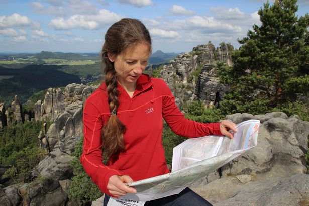
Map, GPS or without it all?

Schrammsteine© Yvonne Brückner

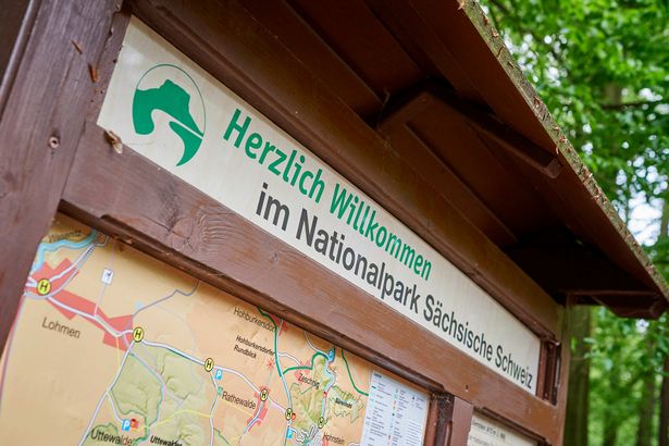
There are only few hiking trails expressively signposted by their names. Such exceptions include the Malerweg Trail, Forststeig or Panorama Path. This small number is because of the very dense trail network and the countless variations of hiking routes. Hiking guide books and hiking tour proposals give safe directions through Saxon Switzerland based on the existing waymarks or close destinations. A map, either paper or digital, however, is recommended. In case you miss a branch-off or a signpost, it helps to find your way. Hikers relying on GPS should keep in mind that sufficient reception is not available everywhere. The best method is to save GPX tracks or digital maps on your device in advance for offline use.


Hiking Maps

Nature Protection in Saxon Switzerland

© Florian Trykowski

Saxon-Bohemian National Park region/Elbe Sandstone Mountains consist of the two National Parks of Saxon Switzerland and Bohemian Switzerland and the surrounding areas classified as Landscape Conservation Area.  There is a total of 710 square kilometres of protected landscape.

Saxon Switzerland National Park stretches over an area of 93.5 square kilometres. It consists of two parts located on the right bank of the River Elbe. The smaller part is to be found around the community of Kurort Rathen, whereas the major part stretches from Bad Schandau Health Resort in the eastern direction toward the Czech border.

Particularly vulnerable natural habitats in the National Park are marked as “Kernzone” (core zone). At the moment it covers about one third of the complete area. Here, a particular code of conduct applies in the interest of nature protection. In the core zone only marked trails are allowed to be used.


Be prepared for an emergency

Notruf Standort Wegweiser© Yvonne Brückner

In case of emergency it is good to know that Saxon Switzerland has a Mountain Rescue Service trained to recover hikers even from impracticable terrain.

But in case of a fire or other emergencies, you should also have the most important telephone numbers ready. Unfortunately, mobile phone reception is not available in all places.

At certain positions you find Mountain Rescue Kits containing first aid equipment. If you need to call for help you should read off the number indicated on the reverse side of the signposts to the Mountain Rescue Service so they can find your exact position.

Arrival by car or by public transport?

© Solveig Großer

For many families, early risers and night owls it is more comfortable to drive to the starting point of a hiking tour. But please be prepared to pay high parking fees for this comfort. Apart from that, there are not enough car parks everywhere. To cope with this problem it makes sense to prepare an alternative hiking tour beforehand.

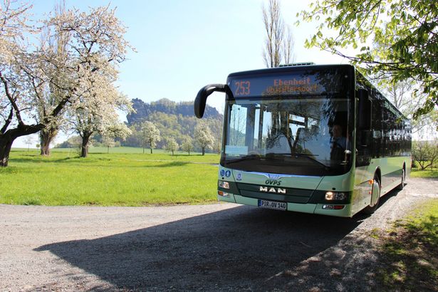
Hikers with the Gästekarte mobil (Mobility Guest Pass) have the great advantage not to need any other ticket for buses or regional (S-Bahn) trains. All guests staying in one of the participating communities automatically get this pass. Many trail heads can be reached by public transport and the choice of tours is not limited to circuit tours.

You may not be as flexible as with your own car, but you make a commendable contribution for the sake of the environment.

Hiking without borders

© Philipp Zieger

The Elbe Sandstone Mountains consist of a German and a Czech part: Saxon Switzerland and Bohemian Switzerland. The landscape is magnificent on both sides of the border. Hikers will hardly notice when they cross the border to the Czech Republic in the countryside.  Border controls have been suspended since 2007. However, also in Bohemian Switzerland there is a core zone where it is not allowed to leave the marked trails.

You should always make sure to have your identity card on you when doing a tour in the border area.

Informationen about Bohemian Switzerland

It appears that you are using Microsoft Internet Explorer as your web browser to access our site.

For practical and security reasons, we recommend that you use a current web browser such as Firefox, Chrome, Safari, Opera, or Edge. Internet Explorer does not always display the complete content of our website and does not offer all the necessary functions.